| TL;DR
Electronic distance measurement (EDM) calculates distance using electromagnetic waves—infrared, laser, or microwave. Laser EDM dominates reflectorless construction work. Infrared systems power most total stations. Microwave supports long-baseline geodetic surveys. Accuracy depends on calibration, atmospheric correction, prism constants, and disciplined field practice. |
Accurate distance measurement sits quietly behind nearly every built structure. Roads align because of it. Bridges close precisely at mid-span because of it. Structural steel stands plumb because someone measured correctly.
As projects scale and tolerances tighten, mechanical methods are no longer sufficient. Electronic systems now define professional measurement standards.
Understanding the types of electronic distance measurement is not simply academic. It determines how reliably a boundary is defined, how confidently a tunnel breaks through, and how defensible survey data remains years after project completion. This guide explains the principles behind EDM, compares its primary methods, examines error behavior, and provides a structured framework for selecting the right system.
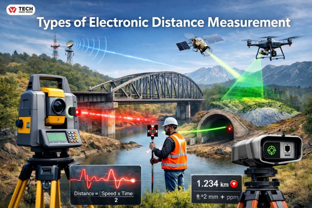
What Are the Types of Electronic Distance Measurement?
The types of electronic distance measurement refer to the methods used to determine distance by transmitting and receiving electromagnetic waves instead of using tapes or chains.
Electronic Distance Measurement (EDM) instruments calculate the separation between two points by analyzing either signal travel time or phase shift. These systems are embedded in total stations, reflectorless laser devices, and specialized geodetic instruments.
The three principal categories are:
- Infrared EDM
- Laser EDM
- Microwave EDM
Each operates on similar physics, yet practical differences in wavelength, range, and field behavior separate them clearly.
Principles of Electronic Distance Measurement
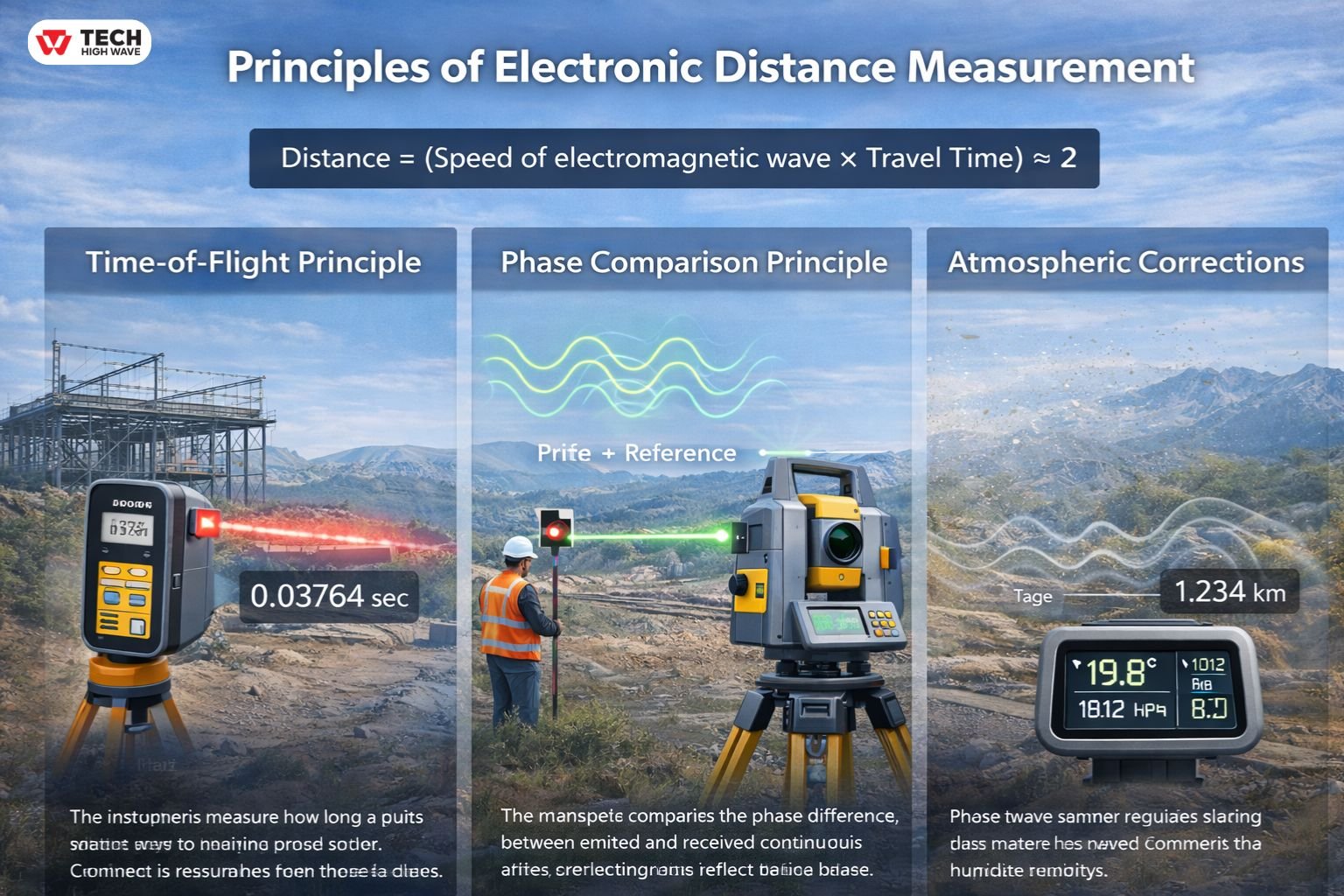
At its core, EDM follows a straightforward physical relationship:
Distance = (Speed of electromagnetic wave × Travel Time) ÷ 2
The division by two accounts for the outgoing and returning signal path.
The simplicity of the formula can be misleading. Field execution is where precision is won—or lost.
Time-of-Flight Principle
The instrument measures how long a pulse takes to travel to the target and return. This method is common in reflectorless laser systems and compact distance meters.
In structural layout work, this allows measurements without physically placing a prism on elevated beams or confined spaces. Safer. Faster.
Phase Comparison Principle
The instrument compares the phase difference between emitted and received continuous waves. This approach is widely used in total station EDM modules and is known for high precision over controlled baselines.
Phase measurement requires stability. Even minor instrument movement can influence readings.
Atmospheric Corrections
Electromagnetic waves do not travel identically in all conditions. Temperature gradients, pressure shifts, and humidity levels affect propagation speed.
On long summer baselines, heat shimmer alone can introduce measurable deviation. Dust and vibration in active construction zones add further complexity.
Accuracy depends on discipline.
Calibration is not optional.
Technical Quick-Reference
For professionals comparing systems, the following summary clarifies core distinctions.
| Method | Wave Type | Best Range | Accuracy (Typical) | Primary Use Case |
| Infrared | Near-IR (0.7–1.5 µm) | 1–5 km | ±(2–5 mm + ppm) | Total stations, general surveying |
| Laser | Visible light | Up to 10 km* | ±(1–3 mm + ppm) | Reflectorless layout, tunnels, structural alignment |
| Microwave | 3–30 GHz | 30–100 km | Moderate (cm-level) | Long-baseline geodetic surveys |
*Actual range depends heavily on reflector use and atmospheric clarity.
Infrared remains common in traditional total station workflows. Laser systems now dominate reflectorless construction applications. Microwave systems serve specialized long-distance geodetic measurement.
Each has its place.
Advantages and Limitations of EDM
Advantages
- High precision over extended distances
- Rapid measurement cycles
- Digital integration with CAD, GIS, and BIM workflows
- Reduced manpower requirements
- Repeatable, documentable outputs
Limitations
- Performance influenced by atmospheric conditions
- Reflectorless readings affected by surface reflectivity
- Requires routine calibration
- Higher capital investment compared to mechanical tools
Even advanced instruments cannot compensate for procedural neglect.
Common Sources of EDM Error
Errors rarely announce themselves. They accumulate quietly.
Instrumental Errors
- Incorrect prism constant setting
- Internal electronic drift
- Calibration lapse
Environmental Errors
- Temperature gradients
- Heat shimmer over asphalt or concrete
- Fog, dust, airborne particles
Target-Related Errors
- Highly reflective metal surfaces
- Transparent or dark materials
- Improper prism alignment
Systematic vs Random Errors
Systematic errors repeat consistently and can often be corrected mathematically.
Random errors vary unpredictably and require repeated measurements to minimize impact.
Professional instruments typically express accuracy as:
±(X mm + Y ppm)
The fixed millimeter value accounts for constant error. The ppm component scales with distance. Over long baselines, that scaling matters.
Also Read: What Is Electronic Software Distribution? (ESD Guide 2026)
Key Features to Look for in Types of Electronic Distance Measurement
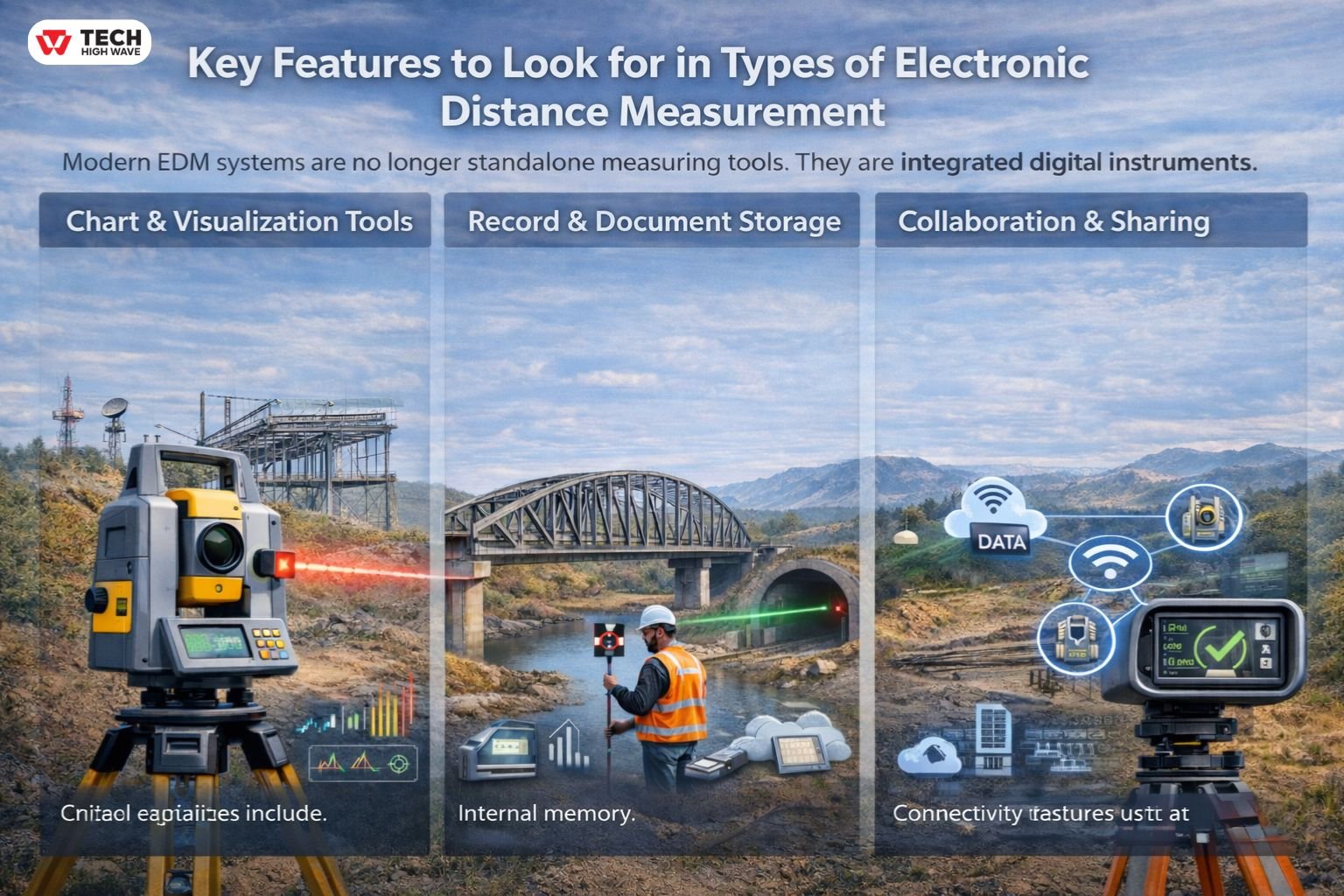
Modern EDM systems are no longer standalone measuring tools. They are integrated digital instruments.
Chart & Visualization Tools
Advanced displays allow operators to:
- Monitor signal strength
- Review measurement history
- Detect instability
- Visualize alignment feedback
In congested job sites, real-time feedback prevents costly repositioning.
Record & Document Storage
Critical capabilities include:
- Internal memory
- USB or wireless export
- CAD and GIS compatibility
- Cloud synchronization
Structured documentation strengthens defensibility in regulated projects.
Collaboration & Sharing
Large infrastructure projects require coordination. Connectivity features such as Bluetooth, Wi-Fi, and total station integration reduce transcription risk and speed field-to-office communication.
Privacy & Data Security
Sensitive boundary and infrastructure data require protection. Instruments increasingly support authentication controls and encrypted export protocols.
Trust is built on measurable reliability.
Best Uses for Types of Electronic Distance Measurement
Infrared EDM
Common in:
- Construction staking
- Boundary surveys
- Control networks
- Topographic mapping
Infrared systems perform reliably when paired with prism reflectors and stable setups.
Laser EDM
Widely used for:
- Reflectorless layout
- Tunnel alignment
- Structural steel positioning
- Industrial facility installation
In tunnel alignment work, laser EDM allows crews to capture precise measurements without sending personnel into unsafe or inaccessible zones.
Microwave EDM
Applied in:
- Long-baseline geodetic networks
- Cross-valley measurements
- Large triangulation systems
Although less common today, microwave systems remain relevant in specialized surveying contexts.
EDM vs GNSS vs LiDAR
These technologies are often compared, yet they serve different purposes.
EDM
- Point-to-point precision
- Ideal for layout and alignment
- Highly controlled measurement
GNSS
- Satellite-based positioning
- Produces coordinates rather than direct distances
- Performance depends on signal availability
LiDAR
- High-density area scanning
- Produces 3D point clouds
- Suitable for terrain and volumetric modeling
EDM frequently establishes control points that strengthen GNSS and LiDAR datasets. In modern workflows, these tools complement one another.
How to Choose the Right Types of Electronic Distance Measurement
A disciplined framework improves selection.
Measurement Range
Short-range indoor measurement → Compact laser EDM
Medium-range construction layout → Infrared total station
Long-baseline geodetic work → Microwave or high-end laser system
Required Accuracy
Boundary definition and legal documentation demand higher precision than general layout.
Environmental Conditions
Heat shimmer, dust, and vibration degrade measurement quality. Instruments with automatic atmospheric compensation mitigate these risks.
Reflector vs Reflectorless
Prism-based setups deliver maximum precision. Reflectorless capability increases flexibility.
Service & Calibration Support
Access to certified baseline testing and long-term maintenance support should not be overlooked.
Equipment selection influences project risk.
Daily EDM Calibration Checklist
Routine verification protects measurement integrity.
Pre-Operation Inspection
- Inspect housing and optics
- Confirm tripod stability
- Verify battery levels
Instrument Verification
- Run internal diagnostics
- Confirm compensator function
- Validate atmospheric inputs
Baseline Accuracy Test
- Measure certified control distance
- Repeat readings
- Document deviations
Prism & Constant Verification
- Confirm prism constant setting
- Ensure correct alignment
Annual certified baseline testing adds further assurance.
Discipline prevents drift.
Troubleshooting Quick Guide
If readings fluctuate → Check tripod stability and surface reflectivity.
lass=”yoast-text-mark” />>If long-distance measurements drift → Reverify atmospheric settings.
>If repeated results vary → Inspect calibration and prism constants.
>If values consistently offset → Suspect systematic instrument error.
Early correction avoids compounding error across project phases.
Future Trends in Types of Electronic Distance Measurement (2026 Outlook)
Electronic distance measurement continues evolving steadily.
- Enhanced reflectorless precision
- Integrated real-time atmospheric sensors
- Stronger digital ecosystem integration
- Greater miniaturization
- Expanded workflow connectivity
The direction is refinement. Not disruption.
Frequently Asked Questions
Q1: What are the main types of electronic distance measurement?
The primary types are infrared, laser, and microwave systems, each optimized for different ranges and surveying applications.
Q2: What affects EDM accuracy the most?
Atmospheric conditions, calibration status, prism constant settings, and surface reflectivity have the greatest impact on precision.
Q3: Which EDM method is most accurate?
High-grade laser EDM systems integrated into professional total stations typically offer the highest precision.
Q4: How is EDM different from LiDAR?
EDM measures specific point-to-point distances, while LiDAR captures dense three-dimensional point clouds across broader areas.
Q5: What is the typical EDM accuracy format?
Professional instruments specify accuracy as ±(X mm + Y ppm), combining fixed and distance-proportional error.
Q6: Can EDM replace GNSS entirely?
EDM cannot replace GNSS but remains essential for precise short-range control and layout work.
Final Notes
A clear understanding of the types of electronic distance measurement enables professionals to align method, accuracy, and workflow demands with confidence. When calibration discipline, environmental awareness, and structured decision-making are applied consistently, EDM remains one of the most dependable foundations of modern surveying and construction practice.
Also Check: Tech-biztech .com: What It Is, How It Works, and How to Evaluate It Effectively