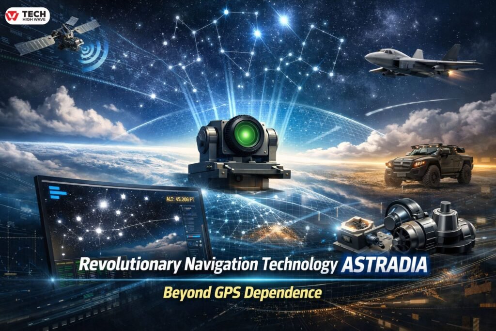
Navigation rarely gets attention until something goes wrong. A system drops out. A position stops updating. A vehicle hesitates when it shouldn’t. By then, it’s already a problem. Satellite navigation has shaped how movement works for decades, but reliance on external radio signals carries risk. Jamming, spoofing, and silent degradation are no longer edge cases. They’re expected conditions in certain airspaces and missions. This is why interest in revolutionary navigation technology Astradia keeps rising. It is often described as a GPS replacement, though that description oversimplifies what it actually does. Astradia doesn’t take over navigation by itself. It reinforces it, stabilizes it, and, when necessary, corrects it.
The distinction matters, especially for anyone looking beyond surface-level explanations.
What Is Revolutionary Navigation Technology Astradia?
Revolutionary navigation technology Astradia, is a celestial navigation system built for modern platforms. It determines position and orientation by observing stars and comparing their relative positions against a known astronomical model.
There are no signals to receive. No transmissions to trust. The system is passive by design.
In real-world deployments, Astradia functions as an absolute reference, not a continuous navigator. Its primary role is to correct accumulated error in an inertial navigation system. Without inertial sensors, Astradia alone cannot maintain uninterrupted positioning.
That limitation isn’t a weakness. It’s an architectural choice.
How Revolutionary Navigation Technology Astradia Works
Astradia only makes sense when viewed as part of a hybrid navigation chain.
First, optical sensors capture star fields. These sensors are engineered to operate in challenging lighting conditions, including daylight at altitude, where atmospheric interference is reduced.
Next, onboard processing matches observed star patterns against a stored catalog. From that comparison, the system determines precise orientation and position.
That solution is then passed to the inertial navigation system. Gyroscopes and accelerometers, which gradually drift over time, are reset back to an absolute reference.
When clouds or obstructions interrupt star visibility, the inertial system continues independently. Once a clear view returns, Astradia recalibrates the solution again.
Navigation continues, without external signals, and without compounding error.
Key Features to Look for in Revolutionary Navigation Technology Astradia
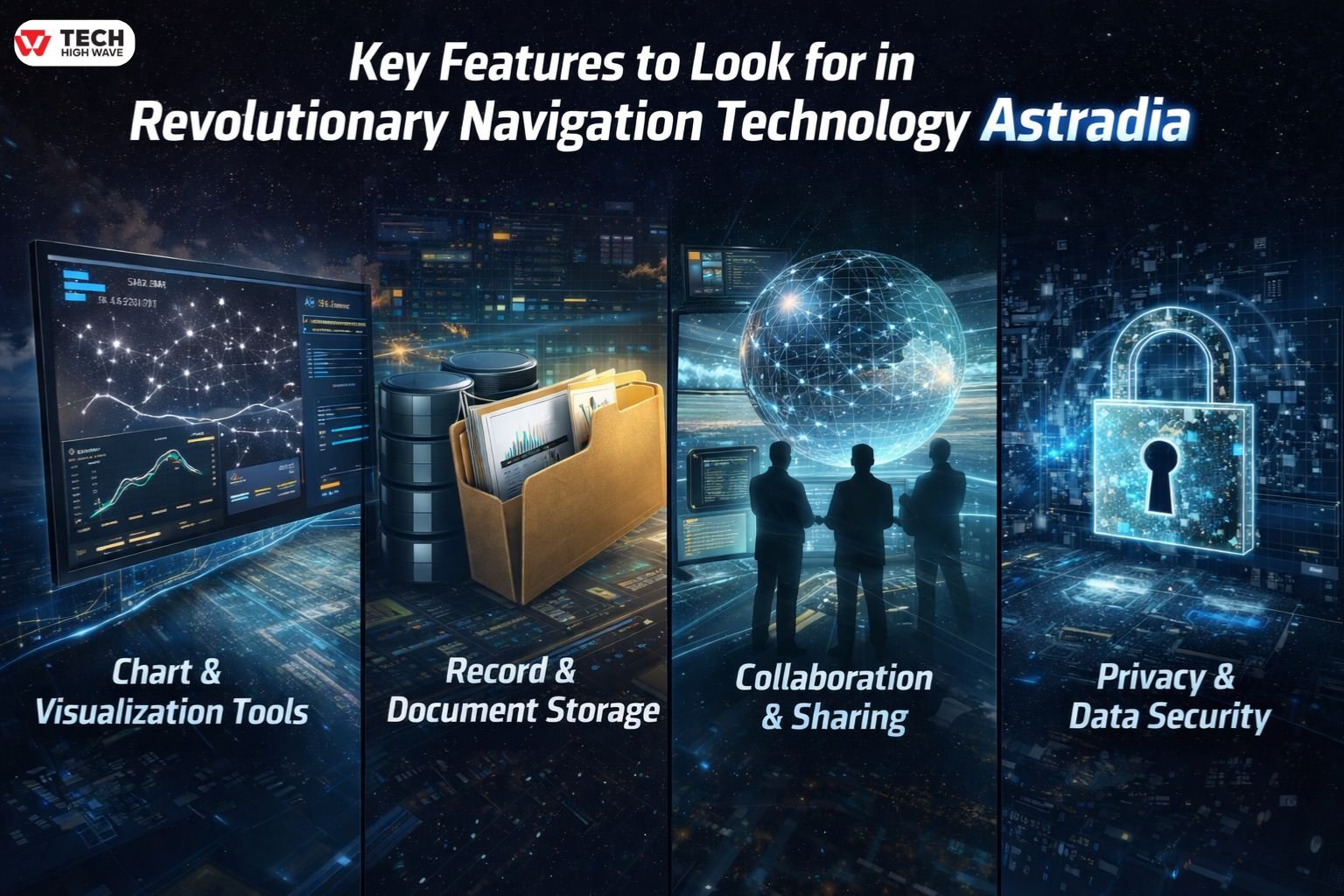
Chart & Visualization Tools
Clear visualization matters more than raw numbers. Operators need to know when a stellar fix occurred, how long inertial carry has been running, and how confidence levels change over time.
A navigation solution that explains itself is trusted longer.
Record & Document Storage
Astradia systems typically log observation events, correction intervals, and inertial behavior. These records are not optional extras. They support certification, troubleshooting, and long-term performance analysis.
Over time, patterns emerge. Weather, altitude, and mission profile all leave fingerprints.
Collaboration & Sharing
Astradia rarely operates in isolation. Its value increases when shared across flight control systems, mission planners, and inertial subsystems.
Disagreement between navigation sources causes more operational issues than outright failure. A shared reference reduces that risk.
Privacy & Data Security
Because Astradia does not transmit navigation data, exposure is limited by default. There is no signal to intercept or manipulate.
In environments where emissions are liabilities, silence becomes protection.
Best Uses for Revolutionary Navigation Technology Astradia
Astradia fits environments where navigation must remain trustworthy under pressure.
High-altitude aviation benefits from improved star visibility above cloud layers. Defense platforms use Astradia to maintain navigation integrity in contested electromagnetic conditions. Long-range unmanned systems rely on it to periodically reset inertial drift during GPS-denied operations.
It is not designed for dense urban environments, ground vehicles, or short-duration consumer navigation. Those expectations belong elsewhere.
Who Should Use Revolutionary Navigation Technology Astradia?
Astradia is intended for operators managing complex platforms with long mission durations. Aerospace manufacturers, defense organizations, and autonomous system developers fall into this category.
Teams without inertial navigation experience often underestimate the integration effort required. For applications prioritizing simplicity and cost over resilience, Astradia offers little advantage.
Suitability depends on context, not capability.
How to Choose the Right Revolutionary Navigation Technology Astradia
Selection starts with understanding constraints.
Operating altitude influences star visibility. Cloud frequency affects correction timing. Inertial sensor quality determines how long accuracy can be maintained between stellar fixes.
Astradia performs best when paired with high-grade gyroscopes capable of carrying navigation solutions reliably during observation gaps.
Evaluating it as a GPS replacement leads to disappointment. Evaluating it as a stabilizing reference produces realistic expectations.
Common Mistakes to Avoid
The most common mistake is assuming Astradia provides continuous navigation on its own. Without inertial sensors, any temporary loss of star visibility interrupts positioning.
Another oversight involves weather planning. Persistent cloud cover or smoke reduces observation opportunities and must be accounted for during system design.
Finally, integration complexity is often underestimated. Astradia delivers resilience through architecture, not convenience.
Related: Neptune Navigation Software in 2026: A Legacy Planning Tool That Still Has a Place at Sea
Navigation Technology Comparison (2026 Standards)
| Feature | GPS / GNSS | Inertial Navigation (INS) | Astradia (Celestial) |
| Signal Source | Satellite radio | Internal sensors | Optical star tracking |
| Jamming Risk | High | None | None |
| Error Growth | None | Increases over time | None |
| Weather Impact | None | None | High (cloud cover) |
| Core Limitation | Spoofing, denial | Drift | Sky visibility |
| Best Fit | Civilian navigation | Short-term continuity | Resilient aviation |
Why the Hybrid Approach Wins
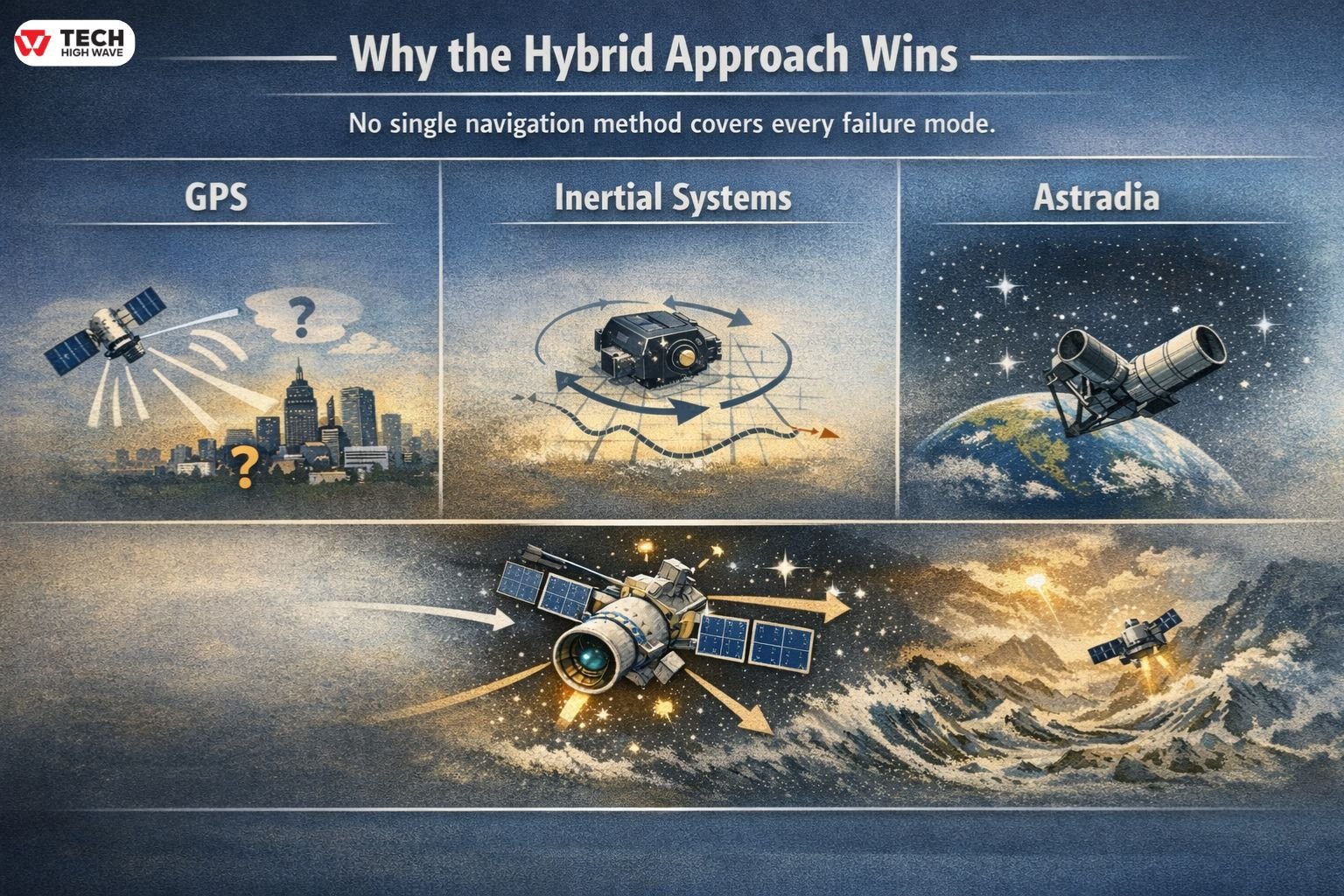
No single navigation method covers every failure mode.
GPS provides convenience and precision, until it doesn’t. Inertial systems maintain motion tracking, but accuracy fades. Astradia restores absolute truth without relying on radio signals.
Each stellar observation resets inertial drift. Together, the system continues indefinitely, even in hostile environments.
Redundancy isn’t optional anymore. It’s structural.
PNT Resilience and the Role of Astradia
Positioning, Navigation, and Timing resilience has shifted from theory to requirement.
Rather than replacing satellite navigation, resilient architectures emphasize diversity. Astradia contributes an independent reference channel, one that operates outside the radio spectrum entirely.
Its role is confirmation, correction, and continuity.
Future Trends in Revolutionary Navigation Technology Astradia (2026 Outlook)
Progress in Astradia is measured, not dramatic. Sensor packages are becoming smaller and more power-efficient. Optical processing is improving acquisition speed and reliability.
Standards bodies are beginning to formalize celestial-inertial hybrids as recognized resilience layers.
Adoption continues quietly, which is often how durable technologies spread.
Frequently Asked Questions
Q.1 Is revolutionary navigation technology Astradia a GPS replacement?
No. It works alongside inertial navigation systems to correct drift when GPS is unavailable.
Q.2 Can revolutionary navigation technology Astradia operate in bad weather?
Cloud cover blocks star visibility, but inertial systems maintain navigation until observations resume.
Q.3 Why does altitude matter for revolutionary navigation technology Astradia?
Higher altitudes reduce atmospheric interference and increase star visibility.
Q.4 Does revolutionary navigation technology Astradia function independently?
Continuous navigation requires integration with an inertial system.
Q.5 What problem does revolutionary navigation technology Astradia address best?
It restores absolute accuracy in GPS-denied or degraded environments.
Q.6 Is revolutionary navigation technology Astradia suitable for consumer navigation?
No. Cost, complexity, and environmental constraints limit its practicality outside specialized platforms.
Conclusion
Revolutionary navigation technology Astradia reflects a broader shift in navigation philosophy. Reliability is no longer assumed. It is engineered, layered, and verified.
By combining celestial observation with inertial navigation, Astradia addresses vulnerabilities that satellite systems cannot solve alone. It is not universal, and it does not need to be.
Where navigation failure carries consequences, independence matters. Astradia provides that independence, quietly, and with purpose.
Also Check: Android Backup Software 2026: A Definitive, Practical Guide